| Cover | Global Links | Solar System | Deep Space | Rockets |
| Satellites | Space Shuttles | Space Stations | Astronauts & Cosmonauts |
Mapping Greenland's Ice Sheet
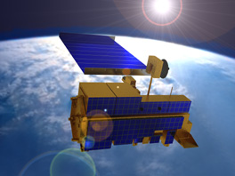
A 21st Century Satellite Orbiting Earth
The European Remote Sensing satellite, ERS-1, carries a radar altimeter which can map precisely the topography of glacier ice sheets.
As global temperatures increase, they melt some polar ice and raise sea levels. At the same time, rising temperatures stimulate precipitation, increasing the size of ice sheets. Scientists need more data about the elevation of ice surfaces to know for sure whether ice sheets in Greenland and Antarctica are growing or shrinking.
They suspect melting of the Greenland glacier raises global sea levels. A nine-inch change in the average height of the central Greenland ice sheet is said to result in a 0.12-inch change in the sea level of the world's oceans.
But, sea levels are difficult to measure directly. Measuring polar-glacier ice sheets is an indirect way to calculate sea-level changes.
In recent years, to measure the surface elevation of polar glaciers, scientists from NASA's Wallops Island Flight Facility in Virginia have been reading the instruments aboard Europe's ERS-1 satellite when it is over Greenland.
Using data from ERS-1 and from several global positioning satellites (GPS), the researchers have been able to compute both buildup and melting of ice on the surface of the Greenland glacier.
For additional data, they flew an aircraft along a path beneath ERS-1 and sent a ground crew from Ohio State University beneath the satellite track to measure surface elevation. Repeated surveys over years show glaciers expanding and shrinking.
SatBytes index Satellites main page Space Today Online cover E-mail Copyright 2001 by Space Today Online