| Cover | Global Links | Solar System | Deep Space | Rockets |
| Satellites | Space Shuttles | Space Stations | Astronauts & Cosmonauts |
What is the Orbit of a Satellite?
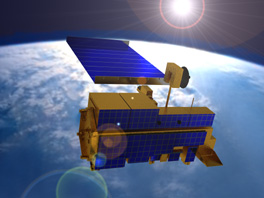
A 21st Century Satellite Orbiting Earth
Most people think of satellites as flying east-west, circling the globe above the equator. Many do fly in such low equatorial orbits, but polar-orbiting satellites travel a north-south path across the poles.
Equatorial and polar satellites mostly fly at low altitudes between 100 and 1,000 miles. To an observer on the ground, they seem to climb up from the horizon, pass overhead, and fall below the horizon several times a day.
Stationary Satellites So-called "stationary satellites" actually are moving in equatorial orbits 22,300 miles above Earth. They are so far above the planet's surface they seem to stand still. ALTITUDES
Polar satellites look down on Earth's entire surface, passing above the North and South poles several times a day. As the satellite loops around the globe, Earth seems to rotate under the orbit.
Sun-Synchronous Satellites Observation of the ground is improved if the surface always is illuminated at the same Sun angle when viewed from the satellite. Many weather, resource and reconnaissance satellites are in so-called Sun-synchronous polar orbits.
Examples include LANDSAT, Nimbus, GEOS, TIROS, NOAA and Navy Oscar satellites. Geodetic-survey and navigation satellites usually are in almost-perfectly-circular polar orbits.
The first polar-orbiting U.S. weather satellite was Nimbus-1 launched in 1964. The first U.S. Earth-resources observation satellite, Landsat-1, was sent to polar orbit in 1972.
Stationary satellites, on the other hand, orbit at altitudes around 22,300 miles. Back in 1945, science-fiction author Arthur C. Clarke imagined communications satellites in stationary orbits where they would travel around the world at the same speed the globe is spinning, making them hang stationary over one spot on Earth's surface.
Transfer Orbit A satellite on its way to stationary orbit is fired to a special equatorial orbit known as a geostationary transfer orbit (GTO). In this highly-elliptical orbit, the satellite swings out 22,300 miles and back in to an altitude of 100 miles above Earth. At an assigned time and place, a "kick motor" attached to the satellite pushes it on out to a circular orbit at 22,300 miles altitude.
The stationary-orbit region of space is referred to as the Clarke Belt. Satellites there are said to be synchronous, geostationary or geosynchronous.
A synchronous satellite has a high, fixed vantage point from which it can look down continuously on a large portion of Earth. That makes stationary satellites ideal for pinpoint broadcasting and for monitoring continent-wide weather patterns and environmental conditions.
Clarke Belt Scores of communications and weather satellites, operated by many countries and international organizations, occupy positions assigned to every nation in the Clarke Belt. Many popular television satellites, sending programs to backyard dish antennas, are in stationary orbits.
The U.S. communications satellite Syncom-3 was the first launched successfully to stationary orbit. Other well-known ones have included Inmarsat and TDRS.
North American cloud photos seen in television weathercasts usually have been made by American satellites known as Geostationary Operational Environmental Satellites (GOES).
Taking a Different Route to Work
While many satellites fly east-west, circling the globe above the equator in equatorial orbits, many others fly in polar orbits, traveling a north-south path across the poles.
Different satellites fly around Earth on different orbital paths. The choice of north-south or east-west route depends upon the job assigned to the satellite. Polar-orbiting satellites provide a more global view of Earth.
Polar satellites look down on Earth's entire surface, passing above the North and South Poles several times a day. As the satellite loops around the globe, Earth seems to rotate under the orbit.
Equatorial and polar satellites mostly fly at low altitudes between 100 and 1,000 miles. To an observer on the ground, they seem to climb up from the horizon, pass overhead, and fall below the horizon several times a day.
Stationary satellites, on the other hand, are in very high equatorial orbits 22,300 miles above Earth. They are so far above the planet's surface they seem to us to be standing still overhead. ALTITUDES
Polar Orbits
Observation of the ground is improved if the surface always is illuminated at the same Sun angle when viewed from the satellite. Many weather, resource and reconnaissance satellites are in so-called Sun-synchronous polar orbits.
Examples include LANDSAT, Nimbus, GEOS, TIROS, NOAA and Navy Oscar satellites. Geodetic-survey and navigation satellites usually are in almost-perfectly-circular polar orbits.
The first polar-orbiting U.S. weather satellite was Nimbus-1 launched in 1964. The first U.S. Earth-resources observation satellite, Landsat-1, was sent to polar orbit in 1972.
Stationary Satellites
Stationary satellites orbit at altitudes around 22,300 miles. Back in 1945, science-fiction author Arthur C. Clarke imagined communications satellites in stationary orbits where they would travel around the world at the same speed the globe is spinning, making them hang stationary over one spot on Earth's surface.
A satellite on its way to stationary orbit is fired to a special equatorial orbit known as a geostationary transfer orbit (GTO). In this highly-elliptical orbit, the satellite swings out 22,300 miles and back in to an altitude of 100 miles above Earth. At an assigned time and place, a "kick motor" attached to the satellite pushes it on out to a circular orbit at 22,300 miles altitude.
The stationary-orbit region of space is referred to as the Clarke Belt. That name is in honor of Arthur C. Clarke, of course. Satellites in the Clarke Belt are said to be stationary, geostationary, synchronous or geosynchronous.
A synchronous satellite has a high, fixed vantage point from which it can look down continuously on a large portion of Earth. That makes stationary satellites ideal for pinpoint broadcasting and for monitoring continent-wide weather patterns and environmental conditions.
Clarke Belt
Every nation on Earth has a set of positions assigned to it in the Clarke Belt. Scores of communications and weather satellites, operated by many countries and international organizations, occupy those assigned positions in the Clarke Belt.
Many popular television satellites, sending programs to backyard dish antennas, are in stationary orbits.
The U.S. communications satellite Syncom-3 was the first launched successfully to stationary orbit. That was in 1964. It made history that fall by sending TV pictures of the 1964 Olympic Games in Japan across the Pacific to the U.S.
Other well-known stationary communications satellites have included Inmarsat and TDRS.
North American cloud photos seen in television weathercasts usually have been made by American satellites known as Geostationary Operational Environmental Satellites (GOES).
Altitudes
Earth is ensnared today under a thick spider web of orbits. Satellites with different assignments fly at different altitudes.
Altitude Miles Satellite Types 100-300 shuttles, space stations, spysats, navsats, hamsats 300-600 weather sats, photo sats 600-1,200 spysats, military comsats, hamsats 3,000-6,000 science sats 6,000-12,000 navsats 22,300 (stationary) communications, broadcast, weather 250-50,000 (elliptical) early-warning, Molniya broadcast, communications, spysats, hamsats
Space Shuttles
U.S. space shuttles are manned satellites of Earth. They usually fly at altitudes around 200 miles above Earth. Rarely, they fly near 400 miles altitude. When in orbit, a space shuttle circles Earth above the equator at a speed of 17,000 mph. Each circuit around Earth takes about 90 minutes and the crew sees a sunrise or sunset about every 45 minutes.
Russia's orbiting space station Mir is another example of a manned satellite. It maintains its own orbit just above 200 miles altitude. The International Space Station being constructed in orbit also is a manned satellite operating at about the same altitiude.
Shuttles and stations fly in equatorial orbits.
Satellite Pictures
Russian and American navigation satellites guide ships at sea from 100 to 300 miles altitude.
Photo-intelligence (PHOTOINT) satellites shoot clear pictures and infrared images of installations on the ground from the same altitude range.
Radar images of targets on Earth's oceans are recorded at these altitudes.
Civilian photography satellites, such as the American Landsat and the French Spot, orbit at altitudes ranging from 300 to 600 miles. American NOAA and Russian Meteor weather satellites are at these same altitudes.
Spy Satellites
Spysats and military communications satellites dominate space from 600 to 1,200 miles altitude. The spysats gather electronic intelligence (ELINT), signal intelligence (SIGINT) and radar intelligence (RADINT). Hamsats also operate there.
Science research satellites do much of their work at altitudes between 3,000 and 6,000 miles above Earth. Their findings are radioed to Earth as telemetry data.
From 6,000 to 12,000 miles altitude, navigation satellites operate. Best known are the U.S. global-positioning system (GPS) and Russia's equivalent GLONASS satellites.
As described above, the so-called Clarke Belt is the region of space 22,300 miles above Earth where satellites seem stationary above the rotating Earth. Best known occupants of the Clarke Belt are the many domestic and international TV broadcast, weather reporting and communications satellites.
TDRS, SDRN, DSCS and UHF
Inmarsats are examples among many non-broadcast communications satellites in the Clarke Belt. Europe's Meteosat and America's GOES are weather satellites in stationary orbits. At the same altitudes, but less-well known, are satellites such as NASA's TDRS (Tracking and Data Relay Satellites), Russia's similar Satellite Data Relay Network (SDRN), U.S. Milstar military communications satellites, the Pentagon's Defense Satellite Communications System (DSCS) and the U.S. Navy's Fltsatcom and Ultra High Frequency (UHF) communications satellites.
The Russians have a series of communications satellites, known as Molniya, in long elliptical orbits which repeatedly carry them out beyond 22,000 miles before they swing back to within 1,000 miles of Earth's surface. Molniyas relay television broadcasts as well as man-in-space and military communications.
Other satellites in such elliptical orbits range from as close as 250 miles out to 60,000 miles. They include intelligence-agency communications craft and early-warning satellites which would report a launch of nuclear weapons.
NASA sketch of what satellite orbits look like
press your browser Back button to return
here after viewing this 40k NASA graphic
Learn more about satellites, shuttles and stations
SatBytes index Satellites main page Space Today Online cover E-mail Copyright 2001 by Space Today Online