Iraq Afghanistan Yugoslavia Intelligence Community
| On March 19, 2003, U.S. President George W. Bush and U.K. Prime Minister Tony Blair sent coalition armies, air forces and navies to liberate Iraq. Guided by GPS space satellites thousands of miles overhead, cruise missiles opened the war with a "decapitation attack" from warships in the Red Sea and Persian Gulf, while stealth fighters dropped precision bombs, also guided by GPS satellites.
President Bush's Address to the Nation >> Prime Minister Blair's Address to the Nation >> |
 USAF Research Laboratory |
Satellites don't attack directly, but rather they offer what the Pentagon calls "force enhancement" — surveillance, reconnaissance, communications, navigation, missile warning.
The spy satellites. The U.S. National Reconnaissance Office (NRO) operates satellites for the U.S. intelligence community. American reconnaissance spacecraft, including the NRO's major equipment, are launched to Earth orbit by the U.S. Air Force and are known by a variety of code names. They are spysats and they include these general types:
- optical satellites that use a large mirror to gather visible light for photography -- like a Hubble Space Telescope pointing down at Earth rather than looking out into deep space,
- infrared and ultraviolet satellites that record invisible infrared and ultraviolet light from below,
- radar imaging satellites that uses microwave signals to peer through cloud cover and scan Earth's surface,
- combo radar, optical, infrared and ultraviolet satellites that see wide areas of Earth's surface with more detail than the separate types,
- signals intercept and detection satellites that tune in on radio, telephone and data transmissions,
- ocean observation satellites used to locate and determine the intent of ships at sea.
Drawing maps. The U.S. National Imagery and Mapping Agency (NIMA) uses imagery from NRO satellites to chart the globe. Spysat images are used by NIMA and other members of the intelligence community to understand enemy activity, plan attack strategies, support covert ground reconnaissance, find enemy sites producing nuclear, chemical and biological weapons, monitor the flanks of deployed troops, watch for shoreline threats to sea lanes, look out for terrorists attack, and locate the sources of intercepted signals.
Disseminating spysat data. How does satellite information get to commanders in the field? NRO personnel from the Army, Navy, Air Force, NSA and the Central Intelligence Agency (CIA) package the data and send it on via American command and control satellites to strike planners on ships at sea, and at naval and air bases and army forts in the Near East, South Asia, Europe, the United States and elsewhere.
Here are some of the super-secret American military satellite systems in use:
Lacrosse is built around a synthetic aperture radar (SAR), which can see through clouds and send down photographic-quality images. Each satellite has a huge wire-mesh radar antenna and 150-ft. solar panels to generate the kilowatts of electricity required by its powerful radar transmitter.
Each Lacrosse passes over its assigned observation target on the ground twice a day, peering down through bad weather to show military commanders elsewhere on the ground where to strike and what damage was caused by strikes. Lacrosse satellites can show objects as small as a foot across at night and in bad weather. Big objects on the ground, like tanks or surface-to-air (SAM) missiles, can be seen even if hidden in a woods.
KH-11 sensors operate in visible and near infrared light, as well as thermal infrared to detect heat sources. The sensors have low-light image intensifiers to see at night. Advanced KH-11 infrared heat sensors detect camouflage and buried structures, and can be used to determine whether factories are operating or not. KH-11 satellites transmit images in real time to ground stations via Milstar communications relay satellites.
Keyhole satellites are in egg-shaped elliptical orbits ranging from a low of 175 miles to a high of 625 miles above Earth. Each passes over its assigned observation target on the ground twice a day.
- KH-1, also known as Corona, was the United States' first photo-reconnaissance satellite. The system operated from 1960-1972. More about Corona >>
- KH-7 was a film-return satellite operated from 1963-67. The older KH-7 offered about 18-20-in. resolution.
- KH-8, also known as Gambit, also snapped photographs with conventional cameras, then dropped their exposed rolls to Earth. They flew 50 missions from 1966-1984. The satellites in that system each carried a single film pod and could fly down as low as 80 miles over the Soviet Union. That allowed them to show things as small as 3-4-in.
- KH-9, also known as Project Octagon, was a film return system of about 20 satellites from 1971-1986. They also snapped photographs with conventional cameras, then dropped their exposed rolls to Earth. KH-9 satellites referred to as Big Birds carried four film return canisters. A typical KH-9 carried two 60-in.-diameter camera lenses for stereo pictures with 6-in. resolution. It has been reported that five of the satellites also had mapping cameras with 12-in. lenses see 9-24-in. objects on the ground. KH-9 photos have been used in maps programmed into the Tomahawk cruise missile navigation system.
- KH-10 would have been used in a once-proposed military space station, the Manned Orbiting Lab. The Lab never flew.
- KH-11 is digital-imaging non-film satellite with 4-6-in. resolution. The first was launched in 1976.
- KH-12, or Advanced KH-11, weighs 30,000 lbs. and can see 100 miles to the left and right of its ground track. The resolution of the optical images are said to be as fine as 4-6 in. during daytime. At night, other infrared and radar satellites can see things as small as 2-3 ft.
 Defense Support Program (DSP) satellite Image: USAF Research Laboratory |
Their infrared sensors detect heat from missile and booster rocket exhaust plumes. They even can detect launch of small missiles to warn of an attack by short-range missles against any target anywhere in the world.
SBIRS High will be a flotilla of satellites in stationary (geosynchronous) orbits and in highly elliptical orbits. SBIRS Low will have satellites flying in low Earth orbit (LEO). Together, the high and low satellites will be integrated into a system offering greater missile warning capability than the older DSP satellites.
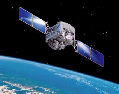 Defense Satellite Communications Systems Image: USAF Research Laboratory click to enlarge |
DSCS satellites are highly important to the American military establishment. Everyone from the President of the United States to special operation troops in the field relies on them for secure communications. Each DSCS also has a single channel for broadcasting emergency action messages to nuclear forces.
- The first small 100-lb. DSCS satellite was launched in 1966.
- The second generation of DSCS started in 1971.
- The third series of 2,550-lb. DSCS began launching in 1982.
DSCS 3-B6, launched August 29, 2003, was supposed to have been launched by space shuttle back in 1986. DSCS 3-B6 and 3-A3 were to have shared the ride to orbit, but the explosion of Challenger changed the plan.
The pair were modified to enhance their capabilities and 3-A3 flew to orbit on the Delta 4 rocket launched March 10, 2003. That made 3-B6 the 65th and last DSCS satellite to launch.
DSCS 3-B6 will replace 3-B7 over the western Atlantic Ocean. The 3-B7 satellite, which was launched back in July 1995 by an Atlas 2A rocket, will be moved to another location.
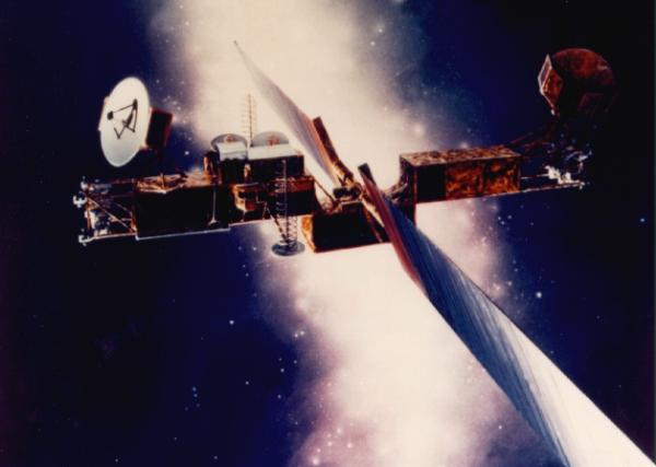 Milstar Satellite Communications System Image: USAF Research Laboratory |
Each giant Milstar is a smart switchboard in the sky, directing encrypted voice, data, teletype and fax messages traffic anywhere on the Earth. Each can link up with other Milstars to forward messages. A Milstar is the size of a city bus with electricity-generating solar arrays as wide as the wingspan of a 747 jumbo jet.
In addition to a pair of DSCS satellites, a third military communications satellite was launched in 2003. It was the sixth and final Milstar satellite ferried to orbit in April by a Titan 4 rocket.
Milstars are the most secure of the various communications satellites. They resist jamming and are hardened against nuclear attack. Milstars can operate in any combat environment with a low probability of detection or interception. In fact, they are used to relay the most sensitive information between the President and the armed forces.
On the other hand, DSCS offers a much larger communication capacity.
U.S. AIR FORCE TITAN 4 FAQ
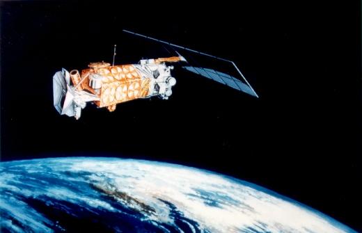 Defense Meteorological Satellite Program (DMSP) Image: USAF Research Laboratory |
Weather conditions across the globe vary widely, of course, which highlights the importance of DMSP satellites, as well as other civilian weather satellites, used to read conditions in target areas. Weather not only affects the timing of air strikes, but also the timing of damage assessments by overflying spacecraft.
At least two DMSP satellites in polar orbits 500 miles above Earth continuously send down visible light photos and infrared images of cloud cover. They also report atmospheric moisture and temperature. Military weather forecasters use such data to predict regional and global weather patterns, including severe thunderstorms, hurricanes and typhoons. DMSP pictures show areas as small as 1,000 feet in diameter.
DMSP satellites also measure charged particles and electromagnetic fields in the ionosphere, which have an impact on the effectiveness of ballistic-missile early warning radar systems and long-range communications. That same data is used to predict global auroral activity, which affects electronics on Earth and in space. Problems in the space environment can affect military satellites.
Meanwhile, at least a dozen other American, European, Russian and Chinese civilian and military weather satellites also deliver images. For instance, the U.S. National Oceanic and Atmospheric Administration operates NOAA and GOES civilian weather satellites. Also in space are European Meteosat, Russian Meteor, and Chinese Feng Yun weather satellites.
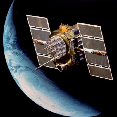
Navstar Global Positioning System (GPS) satellite Image: USAF Research Laboratory |
Navstar GPS is a constellation of more than two dozen orbiting satellites controlled by the U.S. Air Force 50th Space Wing at Schriever Air Force Base, Colorado. It sends navigation data to military and civilian users all over the world.
GPS satellites continuously transmit navigation signals as they circle Earth every 12 hours. Receivers for those signals have been built into cars, ships and airplanes. There also are handheld receivers.
People on the ground, in the air, and on the high seas can receive the signals 24 hours a day and use them to know the time and calculate their location and velocity. The signals are so accurate that time can be figured to within a millionth of a second, speed within a fraction of a mile per hour, and location to within less than 100 feet.
Cruise missiles, and smart bombs dropped by B-1, B-2, B-52 and other bombers, home in on their targets with GPS receivers. Transport planes, U2 spy planes, and aircraft carriers navigate the globe following GPS signals. Troops, tanks and trucks locate themselves with GPS receivers.
NAVSTAR is short for Navigation System using Timing And Ranging. More about GPS >>
 XSS-11 Image: USAF Research Laboratory |
XSS-11 was launched April 11, 2005, on a Minotaur I rocket from Vandenberg Air Force Base, California. Minotaur is a refurbished Minuteman missile.
In numerous tests since then, the 300-lb., dishwasher sized microsatellite successfully rendezvoused with the upper stage of its depleted launch rocket, which is nearby in space. XSS-11 approached as close as 1,500 feet from the discarded rocket.
The XSS-11 project is managed by the U.S. Air Force Research Laboratory, Space Vehicles Directorate Integrated Space Experiments Division, Kirtland Air Force Base, Albuquerque, New Mexico, and operated by the Air Force Space and Missile Systems Center Detachment 12 at Kirtland AFB.
How could the military benefit from the satellite technology demonstrated by XSS-11? A satellite with the slow maneuverability of XSS-11 probably would not be used to attack other satellites. However, there are other non-weapon possibilities:
- A small maneuverable satellite could inspect larger U.S. satellites for accidental or hostile damage. Such a seek-and-diagnose satellite could be sent to space as needed, or one could be attached to a larger satellite at launch and then detach itself to scout around after arrival in orbit. That capability also might be of use during civilian space shuttle flights.
- A small maneuverable spacecraft could fly near a foreign satellite for a first-hand, close-up inspection or to intercept targeted beams of radio or laser communications.
- high-resolution photography satellites usually travel around Earth in low-altitude polar orbits to take advantage of a good Sun angle.
- surveillance satellites often are in stationary orbits at 22,300 miles altitude.
- navigation satellites usually fly mid-altitude orbits at altitudes around 12,500 miles.
- communication satellites usually travel either in elliptical orbits, ranging from 300 to 25,000 miles altitude, or in stationary orbits at 22,300 miles altitude.
2003: Iraq
Afghanistan Yugoslavia SatWars IC
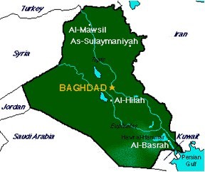 Image: theodora.com |
Six NRO imaging satellites flew over Iraq hourly:
- Advanced KH-11 used low optical light and infrared cameras on northbound passes over Baghdad each day at 2 a.m. The satellite then used its daylight optical light camera as it passed southbound over Baghdad at 3 p.m. The satellite was launched in 2001 from Vandenberg Air Force Base in California to a polar orbit ranging from 256 to 530 miles altitude.
- Advanced KH-11 used its daylight optical light camera as it passed southbound over Iraq around noon. The satellite then used low optical light and infrared cameras on northbound passes over Iraq each day around midnight. The satellite was launched in 1996 from Vandenberg to a polar orbit ranging from 256 to 530 miles altitude.
- Advanced KH-11 used low optical light and infrared cameras on northbound passes over Baghdad each day at 2 a.m. The satellite then used its daylight optical light camera as it passed southbound over Baghdad at 3 p.m. The satellite was launched in 1995 from Vandenberg to a polar orbit ranging from 256 to 530 miles altitude.
- Lacrosse radar satellite passed over Iraq southbound at 3 a.m. and northbound at 5:30 p.m. The satellite was launched in 2000 from Vandenberg to a polar orbit.
- Lacrosse radar satellite passed over Iraq southbound at 10 p.m. and northbound at 3 p.m. The satellite was launched in 1997 from Vandenberg to a polar orbit.
- Lacrosse radar satellite passed northbound over Iraq each day at 11 a.m. and southbound at 8:30 p.m. The satellite was launched in 1991 from Vandenberg to a polar orbit.
 Republic of Iraq Image: theodora.com |
On Jan. 29, 2003, a new GPS satellite was sent up to join the constellation of more than two dozen in space. It would replace a 10-year-old satellite that had been shut down. While it usually takes the Air Force 40 days to checkout a GPS once in orbit, this time controllers rushed to complete the checkout in 20 days. The Air Force planned to send up two more replacement GPS satellites, in March 2003 and July 2003. JDAM bombs and other precision munitions in the American arsenal receive GPS signals for guidance.
Milstar and DSCS satellites were to be launched in March 2003. Another DSCS was to be lofted June 12, 2003, and a Defense Support Program (DSP-23) early warning satellite was to be fired to orbit in August 2003. Secret NRO payloads were to be ferried to space in March 2003, June 23, 2003, Sept. 30, 2003, and in 2004.
More about Iraq:
- Iraq Background and Foreground
- Iraq in the CIA Factbook
- Afghanistan in the Interactive Central Asia Resource Project (ICARP)
- Maps and flags with permission of www.theodora.com
2001: Afghanistan
Iraq Yugoslavia SatWars IC
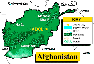 Image: theodora.com |
The military action was in a region of Asia slightly smaller than the state of Texas. Located in Southern Asia, to the north and west of Pakistan, and east of Iran, Afghanistan borders China, Iran, Pakistan, Tajikistan, Turkmenistan and Uzbekistan.
Locally known as Dowlat-e Eslami-ye Afghanestan,it used to be the Republic of Afghanistan. However, there had been no functioning central government in recent years. The country had been administered by factions including the self-proclaimed Taliban government, which referred to the country as the Islamic Emirate of Afghanistan.
A rugged land. Before the start of military action against Usama bin Ladin and the Taliban, Afghanistan was divided along ethnic lines. The Taliban controlled the capital of Kabul and two-thirds of the country including the predominately ethnic Pashtun areas in the south. The opposition rebels had their stronghold in the ethnically diverse north. Afghanistan's 28 million people are mostly either Pashtun, Tajik, Hazara, or Uzbek, although there are some Aimaks, Turkmen, Baloch, and others.
The military action was in terrain that is mostly rugged mountains with plains in the north and southwest. The climate ranges from arid to semiarid with cold winters and hot summers.
To feed the troops' voracious appetite for intelligence information, more than a dozen different kinds of American, British, French and Russian satellites gathered intelligence via photography, infrared and radar imaging, and radio and television intercepts; measured and reported weather conditions; communicated command and control messages and data; and pinpointed targets and located people on the ground.
A fusillade of new spysats. The September 11, 2001, terrorist attacks against the United States left thousands dead. By coincidence, in that time period, the NRO was able to launch a pre-planned series of new and replacement spy satellites. The 2001 launches took on new significance in the post-attack atmosphere.
-
August 17 A Titan 4B rocket was launched from Vandenberg Air Force Base in California carrying what probably was a Lacrosse radar imaging spysat for the NRO. Titan 4B is built by Lockheed Martin and is the most powerful, expendable space launch vehicle in the United States inventory, capable of launching hush-hush cargo payloads weighing 38,800 pounds into low-Earth orbit around the planet's poles.
September 9 International Launch Services (ILS) -- a joint venture of U.S.-based Lockheed Martin and Russian companies Khrunichev and Energia -- launched an Atlas 2AS rocket carrying an NRO payload into orbit from Vandenberg Air Force Base in California. The satellite probably was equipped for signals detection.
October 5 A Titan 4B rocket blasted off from Vandenberg Air Force Base carrying an imaging spysat to a sun-synchronous Earth orbit. The spysat payload probably was a Keyhole photo-electronic satellite. The new satellite, labeled USA-116, probably replaced a six-year-old Keyhole. A Keyhole satellite is a telescope pointed at Earth. It has vision powerful enough to see objects as small as four inches across in visible light. The satellite, built by Lockheed Martin and TRW, probably also has infrared and thermal imaging capabilities. it may resemble the Hubble Space Telescope with a lens barrel and solar wings. However, it would have a propulsion module with engines and fuel for maneuvering in orbit. Such optical satellites help military strike planners monitor movements of groups in Afghanistan.
October 10 ILS luanched an Atlas 2AS rocket from Cape Canaveral Air Force Station carrying a communications relay satellite.
 Ikonos-2 commercial imaging satellite Image: Space Imaging |
To prevent the commercial firm from selling its pictures of the war zone elsewhere, the U.S. government entered into a multimillion-dollar contract with Space Imaging -- a company that sells Earth imagery and information to business, consumer and government customers.
The federal agreement, which the company called "a wonderful business transaction," gave the Pentagon exclusive rights to all of Space Imaging's Afghanistan imagery as well as all of the time that its Ikonos-2 satellite was over the target area. Of course, having the rights doesn't mean the government actually would use the photos.
Ikonos-2 satellite images are said to be among the best available to the public. They were added to photographs already being collected by military satellites and airplanes for the National Imagery and Mapping Agency. That agency provides combat support services to the Department of Defense and the intelligence community. Payment for commercial photos comes out of a classified budget.
Under the month-to-month contract, which started Oct. 7, 2001, the agency paid for exclusive access to Ikonos photos of the area involved in Operation Enduring Freedom, the military code name for the strikes in Afghanistan.
Buying exclusive rights was an attempt to keep the Taliban and Osama bin Laden from knowing where the U.S. military might be looking. For instance, pictures of the Kandahar airfield on Space Imaging's Web site might offer a clue to U.S. plans.
In other circumstances, Ikonos pictures cost buyers up to $200 per square kilometer of imagery plus an extra $3,000 for quick turnaround work. News media had been paying $500 per picture.
One meter resolution. Ikonos-2 has a camera on board that, when shooting black-and-white photos, can see objects on Earth as small as one meter square (three feet or one yard). The company claims, "You can count the cars in a parking lot, tell which are pickups and sedans, and tell what color they are."
One-meter photos might show trees, buildings, cars or boats, but that resolution is not good enough to recognize individual people or read automobile license plates, which are popular benchmarks for the spy trade. Photographs taken from airplanes also can achieve one-meter resolution.
Ikonos' color images have a resolution of four meters (13 feet).
The exact resolution attained by U.S. military satellites is a secret, but experts suggest it is ten times better than the resolution provided by Ikonos. Intelligence analysts estimate that military satellites can take pictures in which objects as small as 10 centimeters in size can be distinguished.
Keeping news media out. American news media often buy satellite pictures of areas of high news value. The act of buying up all rights denies the public an important tool for oversight of government activities. Media suggest that, if the Pentagon were to be the sole source for battle assessment, there would be no independent channel for assessing conduct of the war. Relief workers also could have used Ikonos photos to track refugee movements to plan delivery of food supplies.
Ikonos in polar orbit. Space Imaging launched the 1,600-pound satellite to an altitude of 400 miles in September 1999 on a Lockheed Martin Athena 2 rocket from Vandenburg Air Force Base north of Los Angeles. The company began selling its pictures to the public in January 2000.
The Ikonos satellite travels around the Earth at a speed of four miles per second at an altitude of 423 miles. It crosses over the North Pole, then the South Pole, and back to the North Pole again every 98 minutes.
Under other circumstances, customers use Ikonos pictures for mapping, land-use planning, urban planning and zoning, environmental analysis, oil and gas exploration, agricultural monitoring, insurance and risk management, emergency preparedness and disaster assessment, and many other purposes. The impact of natural disasters can be assessed quickly by comparing before and after images.
Right after the Sept. 11, 2001, terrorist attacks, the company made its photos of the World Trade Center and the Pentagon available free on its Web site.
The first Ikonos satellite was lost in the Pacific Ocean when a protective shroud failed to come off the rocket as planned after launch.
 Islamic State of Afghanistan Image: theodora.com |
The Russians launched a replacement military satellite during the U.S. Afghan military action period. A Proton-K rocket blasted off from Baikonur Cosmodrome in the former Soviet republic of Kazakhstan on October 6, 2001, carrying a Raduga-1 communications satellite.
Afghans use satellites. Space satellites had been used in the past by Afghans. They have had non-military international satellite earth stations and a commercial satellite telephone center in Ghazni. They used an Intelsat communications satellite over the Indian Ocean to link with Iran and an Intersputnik communication satellite serving the Atlantic Ocean region.
More about Afghanistan:
- Afghanistan in the CIA Factbook
- Afghanistan in the Interactive Central Asia Resource Project (ICARP)
- Space Imaging
- A spy in the sky looks at world capitals
- Ikonos-2 satellite background information
- Ikonos-2 satellite technical description
- Government shutter-control orders
- CNN Terrorism Map Room
- National Reconnaissance Office
- National Reconnaissance Office news releases
- The changing character of war [World History Archives]
- U.S. Army
- U.S. Navy
- U.S. Air Force
- U.S. Air Force Research Laboratory
- U.S. Marines
- Visual Satellite Observer's Home Page
- Ulug'bek's Great Observatory at Samarkand
- Map and flag with permission of www.theodora.com
1999: Yugoslavia
Iraq Afghanistan SatWars IC
Navstar Global Positioning System (GPS) satellite Image: USAF Research Laboratory |
It was the largest armada of spacecraft ever brought to bear on a single war in history.
The military action was in a region of Europe known as The Balkans. The name comes from the major mountain chain extending 350 miles across southeast Europe from eastern Yugoslavia through central Bulgaria to the Black Sea. The mountains rise to almost 8,000 feet. The Balkans are a continuation of the Carpathian Mountains. The territory has many challenging peaks and forested valleys.
More than a dozen different kinds of American, British, French and NATO satellites gathered intelligence via photography, infrared and radar imaging, and radio and television intercepts; measured and reported weather conditions; communicated command and control messages and data; and pinpointed targets and located people on the ground.
War machines have become so sophisticated that even the bombs dropped by B-2 bombers home in on their targets with signals from Navstar Global Positioning System (GPS) satellites.
Spysats were very important. The U.S. National Reconnaissance Office (NRO) operated two radar-imaging satellites known as Lacrosse. Each weighs 15 tons and is as big as a school bus. They orbit 400 miles above Earth's surface.
Each Lacrosse crossed the Balkans twice a day, peering down through bad weather to show commanders where to strike and what damage was caused by strikes. They could see objects as small as a foot across at night and in bad weather. Big objects on the ground, like tanks and surface-to-air (SAM) missiles, could be seen even if hidden in a woods.
NRO also has three digital-imaging satellites known as KH-11. They delivered very high resolution pictures in visible light and infrared. They couldn't see through foliage, but they could see at night in good weather.
The KH-11 satellites are in egg-shaped elliptical orbits ranging from a low of 175 to a high of 625 miles above Earth. They flew over the Balkans twice a day. In addition, NRO may have used other spysats crossing over the area. There also were Defense Support Program (DSP) satellites.
How did the satellite info get to commanders in the field? NRO personnel from the Army, Navy, Air Force, Central Intelligence Agency (CIA) and National Security Agency (NSA) packaged the data and sent it on via American command and control satellites to strike planners on ships at sea, and at naval and air bases and army forts.
Weather conditions in Europe vary widely, which highlighted the importance of Defense Meteorological Satellite Program (DMSP) satellites, as well as other civilian weather satellites, used to read conditions in target areas. Weather not only affected the timing of air strikes, but also the timing of damage assessments by overflying spacecraft.
At least ten American and European weather satellites delivered images of Balkan conditions. There were four DMSP satellites in polar orbits 500 miles above Earth. Their pictures showed areas as small as 1,000 feet in diameter.
In additon there were four weather satellites operated by the National Oceanic and Atmospheric Administartion (NOAA) flying in polar orbits. They are known as NOAA-10, -12, -14 and -15.
Two European Meteosat satellites were in geosynchronous or stationary orbit over the area. Meteosat-6 and -7 peered down continuously from the same place in the skies over Europe.
How did commanders know where things were? There were 24 Navstar Global Positioning System (GPS) satellites orbiting Earth. Cruise missiles and some smart bombs were guided by precise timing signals received directly from GPS satellites. Planes and ships navigated the globe with the same GPS signals. Even troops and trucks located themselves with GPS receivers.
Russian spysats were not supporting NATO operations, but were peering down on the scene. It was reported that the Russians had only one digital-image spysat and one radio-receiving sypsat in operation.
More about The Balkins:
- The changing character of war [World History Archives]
- U.S. Air Force
- U.S. Air Force Research Laboratory
- U.S. Navy
- U.S. Army
- National Reconnaissance Office
U.S. Intelligence Community
SatWars Iraq Afghanistan Yugoslavia
Sixteen agencies of the United States federal government compose the nation's Intelligence Community (USIC). Members are Executive Branch agencies, services, bureaus and other organizations with national intelligence roles.
The Central Intelligence Agency, eight offices in the Department of Defense (DoD), and seven other organizations compose the membership list. DoD receives about 85 percent of the national intelligence budget.
The intelligence community operates under the direction of the Office of the Director of National Intelligence (DNI).
The Non-DoD members are:
- Central Intelligence Agency CIA provides foreign intelligence on national security topics.
- National Security Agency NSA collects foreign signals intelligence and protects information systems from compromise.
- FBI Directorate of Intelligence The Federal Bureau of Investigation deals with counterespionage and international criminal cases.
- Department of Homeland Security DHS collects and correlates information pertinent to homeland security.
- National Reconnaissance Office NRO analyzes military and CIA airplane and satellite reconnaissance information.
- State Department Bureau of Intelligence and Research INR deals with information affecting US foreign policy.
- Department of Energy DoE analyzes foreign nuclear weapons, nuclear non-proliferation, and energy security intelligence issues.
- Department of the Treasury Collects information that may affect fiscal and monetary policy.
- Defense Intelligence Agency DIA provides military intelligence to policymakers and force planners.
- National Geospatial-Intelligence Agency NGA, formerly the National Imagery and Mapping Agency (NIMA), provides geospatial intelligence.
- National Air and Space Intelligence Center NASIC, U.S. Air Force, Wright-Patterson Air Force Base, Ohio, collects intelligence relevant to the needs of the service.
- Air Intelligence Agency AIA, U.S. Air Force, Lackland Air Force Base, Texas, collects intelligence relevant to the needs of the service.
- U.S. Army Intelligence and Security Command INSCOM collects intelligence relevant to the needs of the service.
- Office of Naval Intelligence ONI collects intelligence relevant to the needs of the service.
- U.S. Marine Corps Intelligence Collects intelligence relevant to the needs of the service.
- U.S. Coast Guard Intelligence USCG, Department of Homeland Security, collects intelligence relevant to the needs of the service, and correlates information on US maritime borders and Homeland Security.
| Community member list source: USIC |