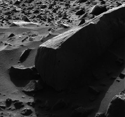
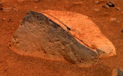
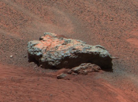
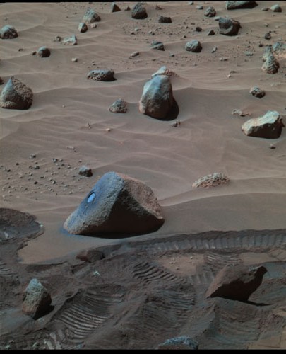
» October 1, 2006: Mars rover Spirit, and its twin Opportunity, still are going strong nearly 1,000 days after their arrival on Mars. Spirit has traveled 3.7 miles. The rovers can move about 44 yards per day. The two rovers are working on opposite sides of the planet. Along their way, they have come upon three meteorites – metallic masses of iron and nickel – that had fallen to the planet's surface sometime in the past from somewhere else in space.
When Spirit's right front wheel stopped working in 2006, its controllers at JPL were able to work around the problem. They simply put the rover in reverse. Now, Spirit can't drive up a slope as steep as before, and the controllers have to be careful when charting its path to keep it away from deep soil.
However, the controllers are surprised that the rovers have kept on working long after their designed lives. In fact, they had to radio new software to the rovers adding a fourth digit to the assignment of tasks for each Mars day. When the rovers were designed, no one had thought they would still be on the job after more than 999 days.
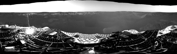
In recent months, Spirit has been merely surviving the cold martian winter. The rover is located in Mars' southern hemisphere, where the Sun crosses low in the northern sky each day. The amount of solar energy available to power the rover drops dramatically during the short winter days. To generate enough electricity to run its heaters overnight to protect its electronics, Spirit's solar panels are tilted toward the sun by parking the rover on a north-facing slope. The rover is parked on top of a small hill named Low Ridge Haven. The winter solstice was August 8, 2006, Spirit's 923rd martian day of exploration.
Even so, the rover has been able to record and transmit a steady stream of science data and images, including a 360-degree, full-color panorama of its surroundings. The rover also has collected long-term observations of the Martian atmosphere, rocks, and soils under varying conditions of sunlight, temperature, and wind.
The working lives of rovers Spirit and Opportunity, were extended for an additional year by NASA. At the same time, the space agency funded two more years of operations from October 1, 2006, for Mars Global Surveyor, which has been orbiting Mars since 1997, and Mars Odyssey, orbiting the Red Planet since 2001. Meanwhile, NASA's newest Mars spacecraft – Mars Reconnaissance Orbiter – began its main science phase on October 1.
On April 23, 2005, Spirit used its panoramic camera to photograph the martian twilight sky above Gusev crater. In the image, the bluish glow above where the Sun had just set would be visible to humans if we were there, but the redness of the sky farther from the sunset is exaggerated compared to the daytime colors of the martian sky.
Picture: martian twilight sky
» January 4, 2006: NASA's Mars Exploration Rover Spirit has completed its second year of science operations on the surface of the Red Planet and is rolling on into a third year.
Originally, the six-wheeled, golf cart sized robot and its twin Opportunity were supposed to work only three months. It turns out, however, they have traveled a total of seven miles during two years in a climate where the average temperature is way below zero and where dust devils fly by at 100 mph.
Back on January, 4 2004, Spirit landed in the rocky, 90-mile-wide Gusev Crater south of the Martian equator on the far side of the planet from the plain where the rover Opportunity would land three weeks later on January 25.
One reason for their survival is the presence of recurring whirlwinds that pass by from time to time and blow off the dust that builds up on their electricity-generating solar panels.
So far, Spirit has driven more than three miles and sent home some 70,000 images including rust-colored planet surface panoramas and self-portraits.
Both of the twin rovers, Spirit and Opportunity, were successful in completing their main goal – uncovering geological evidence that water flowed on Mars sometime in the past.
Spirit found evidence that water had flowed among rocks at Gusev Crater.
The rover completed a tough climb to the top of Husband Hill despite concerns it might not survive the harsh weather. The hill is taller than the Capitol Building in Washington, D.C. (287 feet) and about the height of the Statue of Liberty (305 feet). If you stacked up 725 cans of Pepsi, you would have the height of the soaring summit of Husband Hill.
In its third year, Spirit is beginning to show signs of wear as it heads off toward rugged terrain south of the Columbia Hills referred to by JPL controllers as "the promised land".
Movie: Dust devils sweep the Martian surface
» February 20, 2005: During almost 14 months on Mars, Spirit has driven a total of 2.57 miles (4,143 meters) from the time it landed on January 4, 2004, and its 404th martian day (sol 404 on Feb. 20). A map drawn on an image recorded by NASA's Mars Global Surveyor orbiting spacecraft shows the course the rover has driven during that time. Now, the rover is approaching a ridge overlooking Tennessee Valley on the north flank of Husband Hill in Gusev Crater.
Map: Spirit's 404-day journey
» February 15, 2005: Spirit used its navigation camera to capture the view ahead during the rover's 399th martian day. That's sol 399 or Feb. 15. The drive uphill that day toward Larry's Lookout didn't go so well because the rover's wheels slipped and churned the soil on the slope. Spirit took the moment to turn its alpha particle X-ray spectrometer on the churned soil to see what it might contain. Originally, Spirit was supposed to have worked only 90 sols on Mars.
Picture: looking up to Larry's Lookout
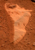
» January 25, 2005: Spirit has been studying Pearce, which possibly is the most important rock it has examined so far on Mars. The rover came across the exposed bedrock on the elevated land known as Columbia Hills in Gusev Crater. Pearce has clear signs of having been altered by water in the past. Analysis shows the rock contains more sulphate salt than any other rock Spirit has examined. When the rock was penetrated by the rover's abrasion tool (RAT), the salt was present deep inside. Sulphur and magnesium could have formed magnesium sulphate. The rock also contains the minerals magnetite, olivine and pyroxene. Where did the salt come from? Liquid water with magnesium sulphate salt dissolved in it, percolating through the rock, then evaporating and leaving the salt behind. Or, from weathering by dilute sulphuric acid reacting with magnesium-rich minerals already in the rock. Either way, the process would have involved water.
Picture: Pearce rock
» January 24, 2005: Spirit is in healthy condition and has driven a total of 2.52 miles around the inside of Gusev Crater. Currently, it is investigating Peace rock near the top of Cumberland Ridge.
Picture: Wishstone rock
» January 3, 2005: Spirit has been working on Mars for a full year, having arrived there on the wind-swept rock-strewn surface of Gusev Crater on January 3, 2004.
The planned 90-day mission for each of the rovers has been extended twice. Opportunity and Spirit are likely to keep on working for some time now that they have passed successfully through the Martian winter. Presumably, the coming spring season will be easier.
The rovers used their geology tools during their first year to uncover direct evidence that the Red Planet once had liquid water. For instance, Spirit discovered in the bedrock of Gusev Crater a mineral called goethite, which forms only in the presence of water. That means Mars once may have had the conditions necessary for life.
Story: One Year on Mars
Flash: One Year on Mars
» January 1, 2005: Spirit is exploring rocks rich in phosphorus in the Columbia Hills in Gusev Crater. Could the rocks have been the result of a meteoroid impact or a volcano eruption?
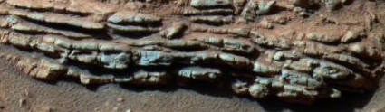
» October 7, 2004: Spirit is climbing higher into the Columbia Hills, after driving more than two miles across a plain to reach them. After finding bedrock that had been extensively altered by water, the rover was searching for relatively unchanged rocks for comparison. However, the fresh rocks examined in the Columbia Hills have shown signs of pervasive water alteration. No unaltered volcanic rock has been found since the rover crossed the boundary from plain to hills. All the rocks in the hills have been altered significantly by water. More clues to the environmental history of the hills may lie in layered rock outcrops farther up the slope.
Picture: Tetl rock layer
» September 21, 2004: Spirit has received a new six-month lease on life. NASA extended its budget for the rover's Mars operations after the robot explorer resumed reliable contact with Earth after Mars passed nearly behind the Sun. The rover was not driven during the 12-day period when radio transmissions were unreliable because of the Sun's position between Mars and Earth. Spirit successfully completed its primary three-month mission on the surface of Mars in April and has been working five months into its first mission extension. Spirit is partway up the west spur of the Columbia Hills highlands, more than two miles from its original landing site.
Picture: Spirit's 238-day trek
» September 1, 2004: Spirit has explored for more than four months beyond its original three-month mission on Mars. The rover's rock abrasion tool has been used nine times to grind into rocks and 28 times to brush rocks. That's a lot more than the criteria for successful use of the abrasion tools established before the trip to Mars, which was to grind at least one rock.
Picture: Toltecs rocks
» August 25, 2004: While the rover Opportunity actually had landed beside exposed bedrock and promptly found evidence of an ancient body of saltwater, it took Spirit half a year of driving across the martian plain from where it landed to reach bedrock in Gusev Crater. Now, Spirit's inspection of the rock outcrop Clovis on a hill 30 feet above the plain suggests that water may once have been active there. The rock is very soft unlike the basaltic rocks on the plain of Gusev Crater. On-the-spot analysis with the alpha particle X-ray spectrometer revealed relatively high levels of bromine, sulfur and chlorine inside the rock. Interaction with liquid water changed the composition of the rock. Out on the plain, Spirit had found coatings and veins on the rocks, which probably meant they were affected by small amounts of water. In the bedrock, the alterations are a great deal deeper, which suggested much more water had been there in ages past.
Picture: Clovis
» August 20, 2004: Spirit has turned up additional evidence of water that may once have washed and altered the rocks where it is on Mars. Atop the Clovis outcrop of Columbia Hills, the rover has seen physical signs of modification by water and sniffed out chemical indications that liquid water changed the composition of rock. Clovis is bedrock in the Columbia Hills 30 feet above the Gusev Crater plain. The NASA JPL team thinks an ancient lava flow covered most evidence of a lake long gone from the plain. Down on the plain, Spirit had seen rocks with coatings and veins representing the after-effect of a small amount of water. Up on the outcrop, the rover encountered deeper and more widespread changes, suggesting more water. The rock on the outcrop was very soft rock, unlike the basaltic rocks down on the plain. The rover's Alpha Particle X-ray Spectrometer (APXS) instrument on the rover's robotic arm recorded relatively high levels of bromine, sulphur and chlorine in the rock - a chemical signature suggestive of alteration by water. At their highest elevation, the Columbia Hills rise 300 feet above the plain. Spirit is working well as the Mars season moves into winter.
Picture: hole drilled in Clovis
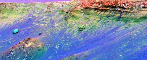
» June 18, 2004: Completing a two-month trip across the martian plain, Spirit began exploring the Columbia Hills, which rise 300 feet above the plain. The rover's drivers back on Earth at JPL are plotting the best route for Spirit to climb the front hill they call West Spur. A direct path straight up the center may be too steep for the rover to climb safely. The JPL team plans to keep Spirit around Columbia Hills for some time, so they may drive it around to the inner basin in the hills. Data from the orbiting Mars Global Surveyor were used to create a digital 3-D color elevation map shows the topography of Columbia Hills facing the rover. Differing colors indicate the slopes of the hills, with red areas being the gentlest and blue the steepest. The blue area dead ahead may be too steep for the rover to climb.
Picture: colorful topography
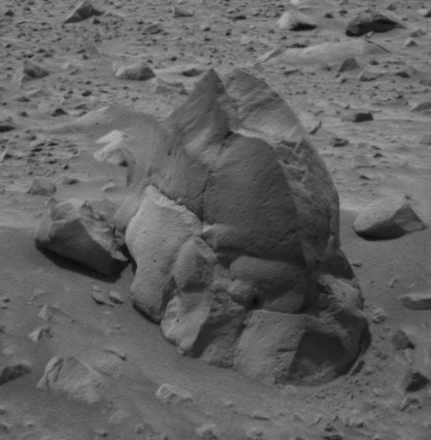
» June 15, 2004: Near the base of Columbia Hills in Gusev Crater, Spirit photographed an unusual rock covered with nodules. The JPL team named the bumpy rock Pot of Gold.
Picture: Pot of Gold rock
Picture: Pot of Gold close up
Picture: Pot of Gold and rotten rocks
» June 11, 2004: Spirit photographed some odd rocks the JPL team called Cobra Hoods. The resistant rocks were not like anything seen before by Spirit on Mars.
Animation: Cobra Hoods
The rover also snapped pictures of a collection of rocks that resemble rotting loaves of bread. Their insides appear to have been eroded, while their outer rinds remain intact.
Picture: loaves of bread rocks
» June 7, 2004: The JPL team controlling Spirit from Earth use Plymouth Rock as a guide to maneuver Spirit closer to Columbia Hills. Plymouth Rock is 20 inches tall and 35 inches across. Plymouth probably is basalt like most of the rocks at Gusev crater. Tiny pits in the rock's surface indicate its volcanic origin.
Picture: Plymouth Rock
» June 3, 2004: Spirit started June with some trenching in the soil, panoramic photography, and driving. It continues to rove across the martian surface toward Columbia Hills. The rover has logged a total of 1.65 miles on its odometer since it left the lander in January. Currently, it's about 0.4 miles from Columbia Hills. It should reach the hills in July.
Picture: Columbia Hills on June 2
Picture: hillside boulders
Picture: Twin Peaks
Picture: Columbia Hills from orbit
Picture: Columbia Hills panorama
» May 17, 2004: Spirit continues its long drive toward Columbia Hills. The rover has logged a total of 1.4 miles on its odometer. At its present position, it is about 0.6 miles from Columbia Hills. It should reach the hills in a month or so.
Picture: Columbia Hills on May 7
» April 23, 2004: Spirit peeked inside and around Missoula Crater with its mini thermal emission spectrometer and navigation and panoramic cameras. The rover also used the panoramic camera to photograph objects named Gratteri Piazza, Wallula Gap, and Clark Fork. The rover then drove 242 feet around a sandy hollow to the east of Missoula and then southeast toward Columbia Hills. The total distance for the day was 0.6 miles.
Picture: closing in on Columbia Hills
» April 16, 2004: Spirit has rolled to within 1.5 miles of its destination, the highlands named Columbia Hills. The hills may consist of older rocks different from the basalts the rover has analyzed.
Picture: Columbia Hills closer
» April 15, 2004: Spirit used its rock abrasion tool (RAT) to brush dust from the rock Route 66 creating a daisy-shaped pattern of circles. Such brushings create a clear place for the rover's miniature thermal emission spectrometer to analyze. The last place the rover did this was on the rock Mazatzal. The JPL team suggests Route 66 and Mazatzal have different kinds of dust coatings because their brushed areas looks different.
Picture: daisy on Route 66
» April 8, 2004: Spirit's mission on the surface of Mars has been extended for five months by NASA. The first of the two rovers to land on the Red Planet, Spirit successfully completed its prime mission on April 3 and 5 when it exceeded 1,969 feet (600 meters) of total driving distance and completed 90 martian days (sols) operating on the surface. The extended period of work will continue into September.
Picture: map of Spirit's travel
NASA constructed a map showing Spirit's travel over 90 days. The map overlays an image recorded by a descent camera seconds before Spirit landed three months ago. Spirit still is sitting on material ejected from the 492-foot Bonneville Crater. That ejecta is white in the overhead photo. Spirit is on its way to the Columbia Hills to the east.
Picture: route ahead to Columbia Hills
The rover has stopped to investigate a rock named Route 66 with its Moessbauer and alpha particle X-ray spectrometers.
Picture: the rock Route 66
» April 2, 2004: Spirit has nine cameras, as does its rover twin, Opportunity. Together, their 18 cameras have sent home to Earth more than 20,000 images to date. As Spirit drove away from Bonneville Crater on the way to Columbia Hills, the rover recorded its last panoramic camera image from the rim of the crater. From that high point, the rover had an excellent view of the rock-strewn path it had crossed. The lander could be seen 1,060 feet away from the rover in the upper right portion of the photo. Grissom Hill was on the horizon.
Picture: Goodbye, Bonneville
» April 1, 2004: Spirit and its rover twin, Opportunity, ended the month of March 2004 by preparing to enter a new phase of martian exploration. In April, the prime three-month missions of Spirit's and Opportunity will end and their extended missions will begin.
Picture: artist's idea of roving Mars
NASA's Jet Propulsion Laboratory at Pasadena, California, built the Mars cruisers to rove across the landscape for 90 martian days. A martian day, known as a sol, lasts about 40 minutes longer than a day on Earth. Because both rovers are healthy as they approach the end of their 90-day assignment, and probably will be able to operate for several additional months, JPL plans to extend their assignments.
Picture: MGS map of ancient ocean
When Spirit landed inside the 95-mile-wide Gusev Crater 12 weeks ago, its main assignment was to find geological clues about whether the region ever had a wet environment.
Picture: Gusev Crater from above
Spirit spent a good deal of time driving toward a 660-foot-wide crater named Bonneville. The JPL team had thought the impact eons ago that excavated Bonneville Crater might have ejected rocks old enough to hold clues about whether Gusev held water.
Picture: Bonneville Crater
Unfortunately, the object that struck Bonneville didn't dig in deep enough to get below the volcanic layer. So, after finishing its work on the crater's rim, the rover headed for the hills. Today, Spirit has left Bonneville Crater behind and is trekking southeast across the plain toward Columbia Hills, a range of peaks which seem to be an island of older rock atop a surrounding layer of younger volcanic surface material.
Picture: looking toward Columbia Hills
Geologists think older rocks may hold evidence of an ancient body of water they suspect once filled Gusev Crater. On the way from Bonneville Crater to Columbia Hills, the rover will stop from time to time to inspect small craters and a dark streak apparently left by a whirlwind that removed dust. The distance to Columbia Hills is about 1.3 miles. It will take the rover 60-90 days (sols) to make the trip.
Picture: Spirit tracks Gusev Crater

|
» October 1, 2006: Mars rover Opportunity has arrived at Victoria Crater and begun examining the layered rocks in cliffs ringing the massive depression.
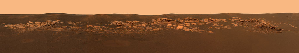
So far, during nearly 1,000 days on Mars, Opportunity has logged 5.7 miles and looked into the three craters. It first examined rock layers inside Eagle Crater, near where it landed on January 24, 2004. Geological evidence gathered at Eagle showed water had once flowed there, and wind had once blown there. Opportunity's second destination was a crater called Endurance, where Opportunity spent nine months examining exposed layers of rock about 23 feet thick. Opportunity found evidence of water at both Eagle and Endurance. Endurance Crater looked like shallow lakes where water may have flowed on the surface. On its trek from Endurance to Victoria, the rover documented wind and water activity with shifting dunes and rising and falling levels of groundwater. Analysis of minerals showed the ancient water was acidic. The rock formations in Victoria Crater were thicker and older than in Eagle and Endurance. Victoria Crater is, by far, the largest of the three craters at half-mile wide and 230 feet deep.
NASA's Mars Reconnaissance Orbiter photographed the rover and its surroundings from orbit above Mars.
Picture: Opportunity at Victoria Crater
» January 25, 2006: NASA's Mars Exploration Rover Opportunity has completed its second year of science operations on the surface of the Red Planet and is rolling on into a third year.
Originally, the six-wheeled, golf cart sized robot and its twin Opportunity were supposed to work only three months. It turns out, however, they have traveled a total of seven miles during two years in a climate where the average temperature is way below zero and where dust devils fly by at 100 mph.
Back on January 25, 2004, Opportunity landed in a small crater on the dark Meridiani Planum plain on the far side of the planet from the crater where the rover Spirit had landed three weeks earlier on January 4.
One reason for their survival is the presence of recurring whirlwinds that pass by from time to time and blow off the dust that builds up on their electricity-generating solar panels.
So far, Opportunity has traveled more than four miles across the planet surface and sent home some 58,000 images including rust-colored surface panoramas and self-portraits.
Both of the twin rovers, Spirit and Opportunity, were successful in completing their main goal – uncovering geological evidence that water flowed on Mars sometime in the past.
Opportunity was first to discover evidence left behind in ancient times that Meridiani Planum was soaked repeatedly with liquid water.
Shortly after it landed, Opportunity sent home a panoramic image of the crater where it had ended up after touching down on the reddish surface. The photo exposed an outcrop of layered rock Martian bedrock – the first of many rocky layers it would come across while exploring Meridiani.
Cross-bedding layers in some rocks left distinct ripple curves in some of the rock outcrops at Meridiani. Bead-like objects, which came to be known as blueberries, were pellets of hematite, a mineral that forms in water. A rock was found containing sodium chloride – commonly known as table salt – which forms only when water has been present. Scientists said the area was soaked over and over in ancient times.
In its third year, Opportunity is beginning to show signs of wear as it heads off toward a distant half-mile-wide depression that JPL controllers call Victoria Crater.
Movie: Dust devils sweep the Martian surface
» February 20, 2005: During almost 14 months on Mars, Opportunity has driven a total of 1.74 miles (2,801 meters) between its landing on January 25, 2004, and its 383rd martian day (sol 383 or Feb. 20). A map drawn on an image recorded by NASA's Mars Global Surveyor orbiting spacecraft shows the course the rover drove during that time. Now, the rover is driving from Endurance Crater toward targets farther south.
Map: Opportunity's 383-day journey
» January 26, 2005: Opportunity is leaving the home it has known for more than 200 Martian days. The rover spent 181 days (sols) inside Endurance Crater, where it had landed in January 2004, furthering human knowledge of the ancient waters of Mars. After completing that work, Opportunity spent 25 days investigating the heat shield that had protected it on its way down to the surface of Mars. Now, Opportunity is heading south toward a small crater named Argo.
Picture: looking back across the plain
» January 24, 2005: Opportunity completed a year (one Earth year) on Mars. The rover continues to be in excellent health as it drives across the plains of Meridiani toward a small crater called Argo. The twin rovers from Earth completed their primary three-month missions on Mars in April 2004. NASA has extended their missions twice since then because the rovers have remained in good condition and are able to continue exploring Mars. During their first year on the Red Planet, the rovers found geological evidence of wet environments that might have been hospitable to life sometime in the past.
Picture: Opportunity's tracks
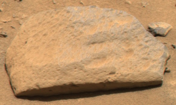
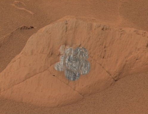
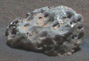
» January 21, 2005: Opportunity found a pitted, basketball-size iron and nickel meteorite, the first meteorite ever seen on another planet. Very few meteorites that have fallen on Earth are similar in composition. The JPL team named the meteorite Heat Shield Rock because Opportunityfound it near the debris of the lander's heat shield on the surface of Meridiani Planum, the cratered plain that has been the rover's base for the last year. The rover's Moessbauer and alpha particle X-ray spectrometers confirmed the meteorite's metallic composition.
Opportunity has driven a total of 1.3 miles around Meridiani Planum. The JPL rover drivers soon will take Opportunity south toward a circular feature called Vostok.
Picture: meteorite on Mars
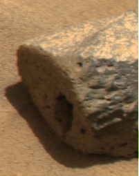
» January 6, 2005: Opportunity has discovered the first meteorite ever seen on Mars. The pitted rock was found near the rover's heat shield lying on Meridiani Planum. The rover's Mini-Thermal Emission Spectrometer (Mini-TES) revealed the pitted, basketball-size object is mostly iron and nickel, which showed it did not originate on Martian. Opportunity used its M�ssbauer and alpha particle X-ray spectrometers to confirm the rock was not Martian. Meridiani Planum is the cratered plain on which Opportunity landed.
Picture: non-Martian meteorite
» January 3, 2005: Opportunity soon will have been working on Mars for a full year, having arrived on January 24, 2004, on Meridiani Planum on the opposite side of Mars some 6,600 miles away from where Spirit had landed 21 days earlier.
The planned 90-day mission for each of the rovers has been extended twice. Opportunity and Spirit are likely to keep on working for some time now that they have passed successfully through the Martian winter. Presumably, the coming spring season will be easier.
The rovers used their geology tools during their first year to uncover direct evidence that the Red Planet once had liquid water. For instance, Opportunity found on the Meridiani Planum the iron sulphate mineral jarosite, which suggests there once was an acidic lake there. That means Mars once may have had the conditions necessary for life.
Story: One Year on Mars
Flash: One Year on Mars
» January 1, 2005: Opportunity is on the plain near the heatshield that protected it a year ago as it descended through the Martian atmosphere. The JPL team is noting how deeply atmospheric friction charred the protective surface layer. The information will be used to improve protection of future landers. The next lander to be sent by NASA will be the Phoenix laboratory in 2007. Before that, the next spacecraft to be sent to the Red Planet by the U.S. space agency will be the Mars Reconnaissance Orbiter to be launched in August 2005.
More about: Phoenix
More about: Mars Recon Orbiter
» December 28, 2004: Opportunity snapped an impressive picture of the site where its heat shield smacked into the surface of Mars on January 25, 2004. The mosaic image set was recorded by the rover on sol 330 (Dec. 28) as the rover was investigating the site south of Endurance Crater. On the left, the main heat shield piece is upside down showing its metallic insulation layer glinting in the sunlight. The main piece stands about about 3.3 feet tall and is about 43 feet from the rover. The other large, flat piece of debris near the center of the image is about about 46 feet away. The circular feature on the right side of the image is the crater made by the heat shield's impact. It is about 9.2 feet in diameter but only about 2 to 4 inches deep. The crater is about 20 feet from Opportunity in this view. Smaller fragments and debris can be seen strewn around the impact site. The impact excavated a large amount of reddish subsurface material. Darker materials cover part of the crater's flat floor and have formed a streak or jet of material pointing toward the two largest heat shield fragments.
Picture: impressive impact
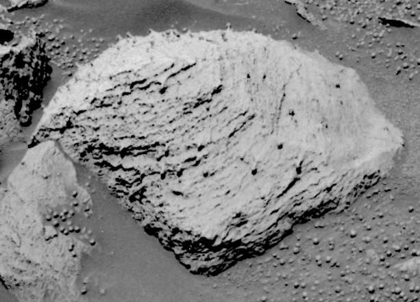
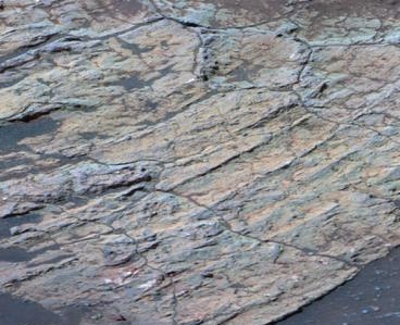
» October 7, 2004: Opportunity has been exploring Mars three times as long as originally scheduled. The more the rover pokes around, the more evidence it finds of past liquid water on Mars. Opportunity established six months ago that the are it is exploring was wet a long time ago. The ancient wet area dried and eroded into a wide plain. The rover is finding that some of the old rocks may have become wet a second time, after an impact excavated a crater the size of a stadium. A flat rock known as Escher and some of its neighbors near the bottom of the crater have networks of cracks dividing the surface into patterns of polygons. They look like cracked mud on Earth after water has dried up.
On the other hand, they may have been fractured by the impact that caused the crater. The rover may uncover an answer in the lumpy boulder Wopmay where it is headed. Finding geological evidence for watery periods in Mars' past is the rover's main goal. Scientists say persistently wet environments may have been hospitable to life. Where would moisture come from? It might have accumulated as frost, which could have melted partially during climate changes when Mars wobbled on its axis of rotation in cycles of tens of thousands of years. On the other hand, underground ice may have melted or there may have been liquid underground water in large enough quantity to form a small lake in the crater. After sniffing around Wopmay, the rover will move on to a tall stack of rock layers known as Burns Cliff. That's where the rover may find a way to climb out of the crater and head south toward the spacecraft's original heat shield and nearby rugged terrain, where deeper rock layers may be exposed.
Picture: Wopmay 'brain' rock
Picture: Opportunity escape plan
» September 21, 2004: NASA will operate Opportunity on Mars for another six months. The space agency extended its budget for the robot explorations after the rover resumed radio contact with Earth after the Red Planet passed nearly behind the Sun. Opportunity was not driven during 12 days when radio signals were unreliable because the Sun was between Earth and Mars. The golf-cart size rover successfully completed its primary three-month mission on the surface of Mars in April and has been working five months into its first mission extension. Opportunity is inside the stadium-size Endurance Crater, driving toward a stack of exposed rocks known as Burns Cliff. There, it may find an exit route from the south side of the crater.
Picture: Earhart rock
Picture: Opportunity's 205-day trek
» September 1, 2004: Opportunity resumed using its rock abrasion tool (RAT) after a pebble fell out. It had been jamming the tool's rotors for two weeks. Jostling of the rover's movements shook it loose. The RAT was put to use, scrubbing dust off of a rock inside Endurance Crater. Then, the tool's grinding rotor cut a hole exposing the interior of the rock.
Picture: the rock Escher
» August 25, 2004: Opportunity has explored for four months beyond its original three-month mission on Mars. The rover's rock abrasion tool has been used 18 times to grind into rocks and five times to brush rocks. That's a lot more than the criteria for successful use of the abrasion tools established before the trip to Mars, which was to grind at least one rock.
Picture: Manitoba is a grindstone
» August 20, 2004: Opportunity has now completed a transect through layers of rock exposed in the southern inner slope of the 425-ft.-wide Endurance Crater on the Meridiani Planum. A transect is a line on the ground along which observations are made and samples are collected at intervals. The rocks examined by the rover ranged from outcrops near the rim down through progressively older layers to the lowest accessible outcrop, called Axel Heiberg. The concentration of chlorine in the outcrop tripled in the rock's middle layers. On the other hand, the amount of magnesium and sulphur declined in older layers. That suggested to the NASA JPL team that those two elements may have dissolved and been removed by water. Blueberries are tiny spheres, called concretions, made of the iron-bearing mineral grey hematite. They abundant on Meridiani Planum. The blueberries may have been formed by water action. The blueberries in the Axel Heiberg outcrop have a rougher texture and are more variable in size than others seen eslewhere by the rover. The JPL team suggested they look more like popcorn than berries. They are the same colour as the rock, rather than grey like blueberries. The rover may drill into a rock called Jiffypop.
Picture: Endurance Crater dunes
» August 4, 2004: The European Space Agency's orbiter Mars Express relayed to Earth pictures from the surface sent up by Opportunity. The interplanetary networking was a demonstration of international cooperation in space research. Mars Express was about 870 miles overhead when it received a collection of 15 images of Endurance Crater from the rover's nine cameras. The relay to Earth was received at ESA�s European Space Operations Centre in Darmstadt, Germany. From there, it was sent on to the Mars Exploration Rover team at NASA's Jet Propulsion Laboratory at Pasadena, California. Previously, Mars Express had tracked a beacon signal from the rover Spirit on August 3 and 6 when the orbiter was about 3,700 miles above the surface. That demonstrated a capability for locating another craft during critical events such as rendezvous or landing. Usually, the NASA orbiters Mars Odyssey and Mars Global Surveyor relay Opportunity and Spirit data to Earth.
Picture: the relayed image
» July 1, 2004: Opportunity started July down inside Endurance Crater collecting science data, drilling into rocks and shooting photos. Exaggerated colors in some of the the images help scientists understand the composition and texture of the rocks. One photo exposed the tailings left when three holes were drilled in Endurance Crater rocks by the rover's rock abrasion tool. The rocks are London (top), Virginia (middle), and Cobble Hill (bottom). The top rock layers are yellowish red, the middle are yellowish green, and the lower are green.
Picture: stretched colors
» June 23, 2004: One of the areas photographed by Opportunity's microscopic imager in Endurance Crater was the finely-laminated rock named Cobble Hill.
Picture: Cobble Hill
» June 22, 2004: Opportunity images collected for a mosaic showing the area it is studying inside Endurance Crater showed distinct layers of rock defined by subtle color and texture variations. The deeper the layer, the farther back in time the rocks were formed. The top layers are rich in sulfate, like the rocks observed by the rover earlier in Eagle Crater.
Picture: Endurance Crater mosaic
» June 18, 2004: Opportunity drove 16 feet down into Endurance Crater, stopping to investigate a flat rock named Tennessee, which may have been made of the same water-lain, evaporite-rich materials as those the rover found back in Eagle Crater where Opportunity landed. The rover used the rock abrasion tool to drill into Tennessee for a look at its inner mineral composition. The grind was the deepest drilling so far by Opportunity. The hole took 2 hours and 4 minutes to complete to a depth of 0.32 inches. The previous record was a 0.28-inch-deep hole drilled in the rock Pilbara in Fram Crater back in April. Opportunity continues to investigating Endurance Crater.
Picture: Tennessee hole
» June 3, 2004: Opportunity started June on the edge of Endurance Crater shooting panoramic photos and resting to recharge its battery. In a June 2 image of Endurance Crater, false-colors show various minerals along the rim of the impact crater. The image used all 13 color filters in the rover's panoramic camera. Cyan blue denotes basalts. Dark green is a mixture of iron oxide and basalts. Reds and yellows are dusty material containing sulfates.
Picture: mineral colors
Meanwhile, the NASA JPL team wondered whether ripples in a microscopic imager photo might indicate the presence of water in the past.
Picture: water ripples
A panoramic camera view of the southeast side of the rim of Endurance Crater showed interesting braided patterns on a rock named Pyrrho.
Picture: Pyrrho rock
Previously, as it was traveling to Endurance Crater back on April 23, Opportunity had photographed a 26-ft.-wide impact crater named Fram on the Meridian Planum.
Picture: Fram crater
» May 18, 2004: Opportunity continues to dig down into the dirt, scuff the top of the soil and cruise around the edge of Endurance Crater. The rover is healthy, but its battery is a bit run down. It tarried a bit today for a time of solar recharging. Earlier, the rover take a close look at a rock called Lion Stone. The rock is about four inches tall and 12 inches long.
Picture: Lion Stone
» April 22, 2004: Opportunity broke its own record for the deepest hole ground in a rock on another planet with a 0.28-inch grind into the rock Pilbara. Those now-famous blueberry spheres also are present on this rock, however they don't look the same as blueberries seen earlier. These blueberries sit on stems, which make them seem like golf balls on tees. The left side of the rock is relatively free of berries.
Picture: the rock Pilbara
» April 16, 2004: Opportunity looked out across the rippled, pocked plain toward its destination, Endurance Crater. The plain, blanketed by grains of various sizes, seems uniform all the way to Endurance Crater. The surface is paved with larger grains. Smaller grains form small dunes, which include those spheres called blueberries, both intact and broken. Pebbles about 0.4 inches in size are a third feature on the plains. Looking down from its orbit above Mars, the Global Surveyor spacecraft had spotted hematite, which led NASA to choose Meridiani Planum for Opportunity's landing site. Along the way to Endurance, the rover will stop at a small crater called Fram.
Picture: the path to Endurance Crater
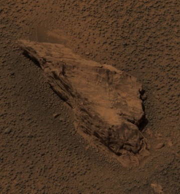
» April 14, 2004: Opportunity has discovered that the rock Bounce it found on Meridiani Planum has a mineral composition similar to a meteorite found on Earth in 1979. The JPL team suggests the two rocks share a common origin. Bounce may have originated somewhere beyond Opportunity's landing site. An impact probably threw the rock and the meteorite found on Earth away from their original home. That impact probably threw the rock, labeled EETA79001, off Mars and toward Antarctica on Earth where we found it and called it a meteorite. The 17.6-lb. meteorite was collected in the Elephant Moraine on the continent of Antarctica. A basalt lava rock that looks like most any other rock on Earth, the meteorite was the first strong proof that meteorites could come from Mars. In a NASA picture of the sawn face of the fine-grained gray rock, the vertical stripes are saw marks. The black patches are melted rock, or glass, formed when a large body hit Mars near the rock. The black glass contains traces of the gases in the martian atmosphere.
Picture: Mars rock on Earth
» April 9, 2004: Opportunity used its rock abrasion tool (RAT) to grind into the surface of a rock named Bounce. The rock is 14 inches long and 4 inches high. The RAT hole is 0.25 inch deep and 1.7 inches across. It took the RAT 2 hours 15 minutes to cut the depression circle into the rock.
Picture: RAT hole in Bounce
» April 8, 2004: Opportunity's mission on the surface of Mars has been extended for five months by NASA. The second of the space agency's twin rovers to land on the Red Planet, Opportunity touched down three weeks after Spirit on Jan. 24 in a small bowl the JPL team named Eagle Crater. Opportunity will complete its prime mission of working 90 martian days (sols) on April 26. Each martian day (sol) is 40 minutes longer than an Earth day. NASA used a photo taken from orbit by the Mars Global Surveyor orbiter to create an image showing the starting point and intended destinations for the rover moving across territory within Mars' Meridiani Planum region.
Picture: Meridiana milestones
Opportunity's navigation camera photographed a sinuous trough named Anatolia in the plains of Meridiani Planum. It shows bedrock that may be like that in Eagle Crater" outcrop.
Picture: Anatolia milestone
The rover spent about two months examining rocks and soil inside Eagle Crater, then set out for a larger bowl the JPL team named Endurance Crater. Opportunity's extended period of work will continue to the end of September. During that time it will complete examining Endurance, then drive across the landscape to the southeast toward area now known as "etched terrain" where deposits of layered bedrock may be exposed.
Picture: Anatolia trough
» April 2, 2004: Opportunity used its panoramic camera to make a color snapshot of Bounce Rock, a big stone that was struck on January 24, 2004, when the rover's lander, swathed in airbags, was bouncing and rolling to a stop during touch down on the Red Planet. Two months later, Opportunity had driven to within about 16 feet of the rock when it recorded the color snapshot. Then it drove right up to the rock for some close-ups and to grind into the rock with the rock abrasion tool (RAT). At 14 inches long and 4 inches high, Bounce is the largest rock for as far as the rover's eye can see. It seems the rock has a dusty coating on top, which may have been broken when it was struck by the lander's airbags.
Picture: Bounce Rock
Picture: Bounce Rock closeup
» April 1, 2004: Opportunity, like its rover twin Spirit, is starting a long trek. It has climbed out of the small impact basin, named Eagle Crater, where it landed nine weeks ago. An outcropping of bedrock inside the crater provided evidence that the site was once under flowing water. In coming weeks, Opportunity, will drive about half a mile to a crater the JPL team calls Endurance. There, geologists hope to find thicker bedrock to learn more about the duration of the region's wet history.
Picture: watery clues
Before leaving Eagle Crater, Opportunity, inspected the martian soil at five sites in the opposite half of the crater from the outcropping of bedrock. The patches of soil revealed a variety of sizes and shapes of surface particles. Geologists suggested the martian wind may have blown some small particles away and left large particles behind.
Story: patches of martian soil
Opportunity found those tiny gray spheres that have been likened to blueberries are more plentiful in soil patches higher on the inner slope of Eagle Crater.
Picture: Opportunity sees blueberries
A reading by the rover's M�ssbauer spectrometer on one of the higher patches found the largest concentration of hematite seen so far on the martian surface. The type of hematite Opportunity found usually forms on Earth under wet conditions.
Picture: blueberries on Shoemaker's Patio
|


